At Drone Works Consultancy (DWC), we offer UAV surveying and mapping services that enable efficient, contact-free, and highly precise 3D surveys of large and hard-to-access ar-eas. Using photogrammetry and laser scanning technolo-gies, we generate a 3D point cloud from the data captured dur- ing UAV flights. This data is processed to produce accurate, georeferenced orthomosaic photos, digital terrain models (DTMs), and other vital mapping results.
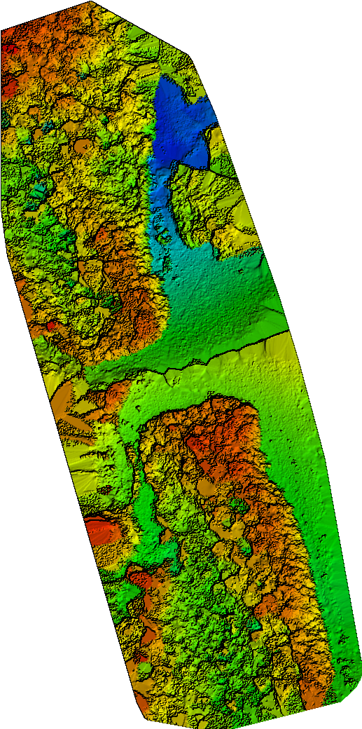
Capturing Surface Structures in 3D : Our UAVs generate a dense point cloud using photogrammetry or LiDAR scanners. The point cloud serves as the foun- dation for producing detailed outputs like 2D maps, 3D terrain models, and digital surface models. It is an essential tool for visualising complex surface structures and objects in a 3D coordinate system.
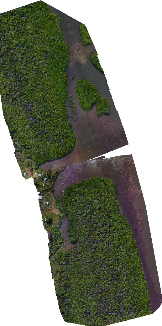
Distortion-Free Aerial Imagery : We create orthomosaic photos (also known as orthophotos) that offer distortion-free, true-to-scale images of the earth's surface or man-made structures such as façades and bridges. The images are perfectly aligned through bundle adjustment, ensuring accurate depiction for use in surveying, cartography, and GIS applications.
Precise Aerial Images with Spatial Reference : Our georeferenced orthomosaic photos are distortion-free and aligned with a spatial reference system, providing highly accurate data for urban and rural planning, visualisation, and various other applications. The imagery can be scaled and customised according to project needs, making it ideal for surveys and construction documentation.
Exact Measurements for Landfills, Quarries, and Stock- piles : Using 3D point clouds generated by our UAVs, we perform ac- curate volume calculations and quantity surveying for large areas such as stockpiles, landfills, and construction sites. These measurements provide precise data on actual conditions, allowing for target/actual comparisons and delta calculations over time. This service is essential for tracking stock levels, project progress, and volume changes.
Accurate Elevation and Surface Models : We create digital terrain models (DTMs) and digital surface models (DSMs) for highly detailed and realistic depic- tions of landscapes and structures. DTMs represent only the natural surface of the earth, excluding vegetation and other el- ements, while DSMs include all surface features, such as trees and buildings. These models are essential for applications in construction, urban planning, and environmental management.
High-Resolution Aerial Imagery : Ground Sampling Distance (GSD) refers to the resolution of an aerial image. The lower the GSD value, the more detailed and precise the image. For example, a 1 cm GSD means that each pixel in an image represents 1 cm on the ground. This en- ables highly detailed and accurate aerial photography for projects requiring top-notch precision.
Contact Drone Works Consultancy : today to discuss how our UAV surveying and mapping services can help you achieve high-precision data collection for your next project.